
4.9/5
( 203+ reviews)
Features GeoInfoMex
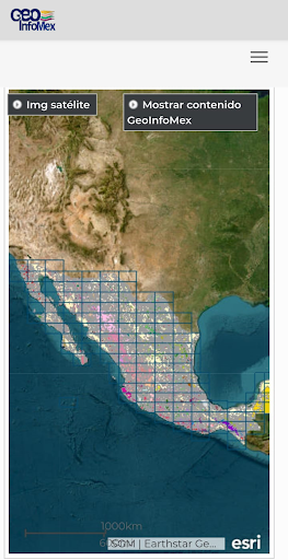
GeoInfoMex is the Mexican Geological Service consultation system that allows users to know the geoscientific, geological-mining and geophysical information of the Mexican Republic, combining the information levels of:-Geological-mining, geophysical, geochemical mapping.-Information of mines, beneficiation plants and sizable rocks.- Agrarian nuclei (ejidos) of the National Agrarian Registry.- CONANP protected natural areas.- Earthquakes (SSN, IG-UNAM).-Cencas hydrological (CNA), among others.
🛡️
Secure & Private
Your data is protected with industry-leading security protocols.
Screenshots
See the GeoInfoMex in Action

Get the App Today
Download on Google Play
Available for Android 8.0 and above